Maps·1816
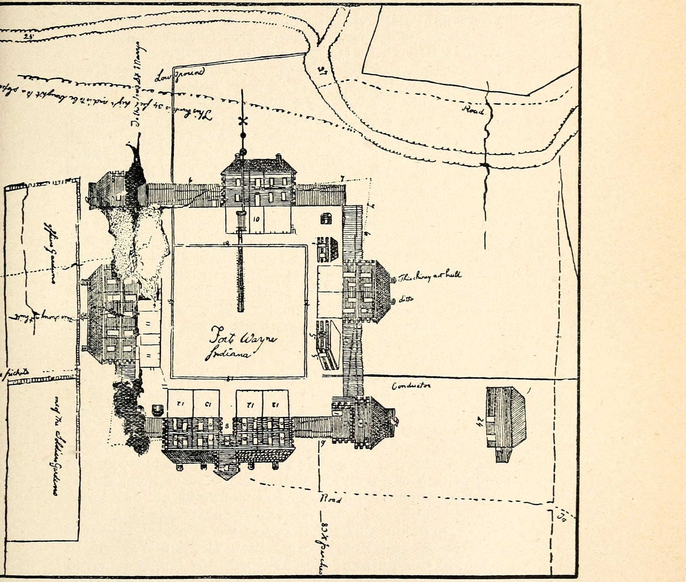
Major Whistler’s plan of Fort Wayne, August 1816
This map is printed across two leaves and this is one of them. Whistler’s ground outside the pickets, 1816
This plate is not tiled, so it cannot be zoomed here. What is served is the whole plate at its full scanned width, and the item it came from is linked below.
The Pictorial History of Fort Wayne, Indiana, by B. J. Griswold, 1917, printed page 157, scan leaf n164.
Internet Archive
Public domain. Published before 1929, so out of copyright in the United States.
Crop box Leaf n164, cropped from (10,916), 2290 by 1942. Nothing rotated. on the source sheet.
Served at /maps/sheet/whistler-1816-fort-plan.