Maps·1816
Whistler’s ground outside the pickets, 1816
This map is printed across two leaves and this is one of them. Major Whistler’s plan of Fort Wayne, August 1816
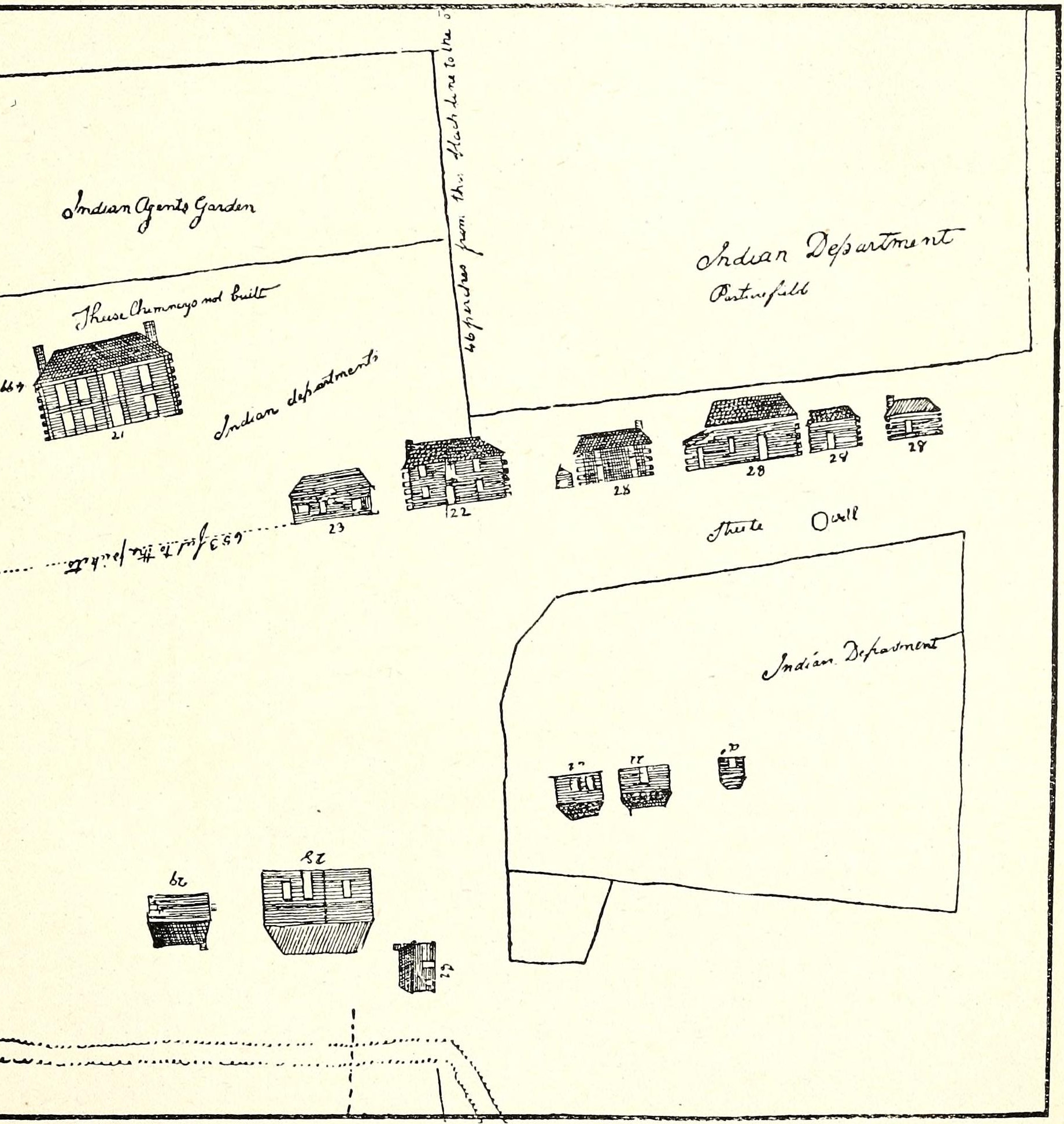
The ground outside the pickets: the Indian Agent’s garden, the Indian Department’s pasture field, and a row of quarters and stores drawn in elevation and numbered 21 to 29. Griswold’s volume prints this plate upside down and it has been turned here so that most of it reads. Some of Whistler’s own labels were written the other way up and are still inverted, which is how he drew them.
This plate is not tiled, so it cannot be zoomed here. What is served is the whole plate at its full scanned width, and the item it came from is linked below.
The Pictorial History of Fort Wayne, Indiana, by B. J. Griswold, 1917, printed page 156, scan leaf n163.
Internet Archive
Public domain. Published before 1929, so out of copyright in the United States.
Crop box Leaf n163. The volume prints this plate upside down, so the leaf was turned a half turn before cropping, and the box is on the turned leaf: from (124,929), 1840 by 1944. Nothing else was done to it. on the source sheet.
Served at /maps/sheet/whistler-1816-outbuildings.